
Under imported photos, the list can be placed in alpha order.
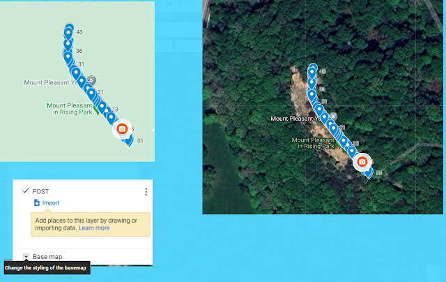
Clicking on a mark/place, the pencil to edit, I used the number of the post.
There is no post (6) between 5 and 7, so I added a spot where it could have been.
Because the trees blocked the view in many spots I did pics of the post, to get the gps positions

Because a map can get so busy with markers, I guess using layers, lets you toggle between them or merge them all together.
Changing the marker for different layers might help.
Meta Data
Changing the marker for different layers might help.

Meta Data
Using exif pilot
Click on pic
Exif
Import/export
In the same folder it will have the same name with a text extension
Exif viewer works view only, single items can be copied.
Windows rejects exif tools
.