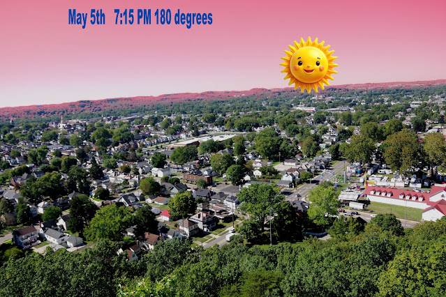
Video of the sunset location for each day of the year.. kind of
The video will include each day of the year, each will have the direction the sun will set from the Mt perch.
It will actually "move" across the sky starting Jan left to right until June 20th, then reverse the direction
It will actually "move" across the sky starting Jan left to right until June 20th, then reverse the direction
The picture of our stomping grounds will remain the same but will change colors for the seasons .
The sun will move just like in the map video.
The sun will move just like in the map video.
The degrees get bigger after Dec 21 so I guess, the sun needs to start moving left to right again.
(just my paint program ctrl shift q 'pixels', enter the position, save and move again)
I created a sunset video in the past using maps, but it appears on the left
This video would be the actual place you would see if you were standing on top of Mt P.. and change with the seasons,
Creating a daily video of sunsets each year will take a panoramic
Dec 20th the sunsets about 240 degrees. June 20th 302 degrees
Because of the trees on top you can not sweep the whole area. The question is, is there an area below the camera can capture the whole path with no obstructions?
Jan 1 240.37° --> 171 days
June 20 301.95 <-- 183
Dec 20 239.66 --> 11
Dec 31 240.23° % of 61 ? x pix
301-239.66 = 61.34
After figuring out the position, a file or gwbasic can create files with the sun position each day and use macro express to load that pic, position the sun
clipboard file copy and paste in m10 fields
After figuring out the position, a file or gwbasic can create files with the sun position each day and use macro express to load that pic, position the sun
clipboard file copy and paste in m10 fields


